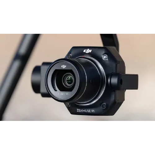
About Zenmuse P1 Camera
Take advantage of the unprecedented Zenmuse P1 Camera-DJI's premier solution for industrial mapping and surveying. Featuring a gilt-edged 45MP full-frame CMOS sensor and modular interchangeable lens system, the P1 is purpose-built for aerial photogrammetry with unmatched flexibility. Get it now at a reduced rate and experience global shutter support, precision geo-tagging, and robust TimeSync 2.0 integration for real-time mapping. Its carbon fiber build, smart oblique capture, and advanced 3-axis stabilization deliver low-noise, high-sensitivity imaging in every mission. Ideal for geomatics, precision agriculture, and infrastructure inspection.
Engineered for Precision Mapping and Industrial Applications
Zenmuse P1 stands as a cutting-edge solution designed for aerial surveying, photogrammetry, building modeling, and geographic mapping. Leveraging Smart Oblique Capture and automatic geo-tagging, it ensures efficient land management and infrastructure inspections. Its full-frame sensor coupled with a 3-axis stabilized gimbal allows high-efficiency data capture, even in low-light conditions, making it indispensable for resource management, construction, and precision agriculture projects.
Export Markets, Supply Policies, and Secure Packaging
Zenmuse P1 Camera is supplied across key export markets with a focus on reliable transportation and swift arrival. Our packaging details ensure the camera arrives in secure, shock-resistant boxes for optimal protection during transit. Sample policies are available for qualified buyers, offering a hands-on experience with our flagship product before large-scale supply. Each shipment is tracked to uphold timely delivery and quality assurance, supporting enterprise-level demand seamlessly.
FAQ's of Zenmuse P1 Camera:
Q: How is the Zenmuse P1 Camera typically used in industrial applications?
A: The Zenmuse P1 Camera is designed for aerial surveying, photogrammetry, and geographic mapping, supporting precision land management, building modeling, and infrastructure inspection with its high-resolution imaging and geo-tagging features.
Q: What special features does the Zenmuse P1 offer for mapping accuracy?
A: With its Smart Oblique Capture, automatic real-time GNSS geo-tagging, and TimeSync 2.0, the P1 ensures precise and efficient mapping, enabling high-accuracy data acquisition for advanced surveying needs.
Q: Where can the Zenmuse P1 Camera be deployed for optimal results?
A: It can be deployed with DJI Matrice 300 RTK or Matrice 350 RTK drones in diverse environments-urban, rural, or industrial-making it ideal for construction sites, farmlands, and large-scale resource management projects.
Q: When is the best time to use Zenmuse P1's low-noise imaging capabilities?
A: The camera's low-noise high-sensitivity sensor excels during early morning, late evening, or in overcast and low-light scenarios, ensuring clear and detailed images at any time of day.
Q: What is the process for data transfer and storage with the Zenmuse P1?
A: Captured data can be easily stored on detachable SD cards (up to 512GB) and transferred via USB-C, making processing and analysis highly efficient for industrial workflows.


 Send Inquiry
 Send SMS